
Alla auktioner / Böcker, Kartor och Texter / Jamaica - Jamaica; N. Bellin - Carte de l'Isle de la Jamaique - 1751-1760

Jamaica - Jamaica; N. Bellin - Carte de l'Isle de la Jamaique - 1751-1760
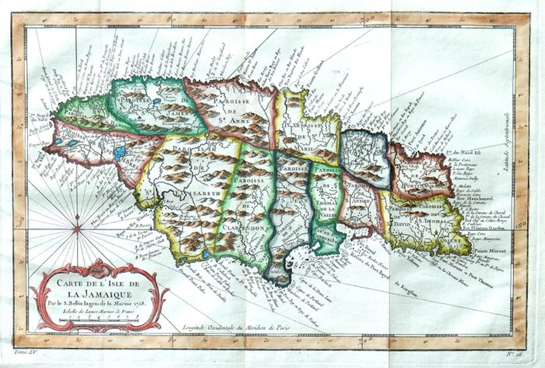
Dimensions: 20.5 x 31.5 cm. (on sheet: 25 x 37 cm.). Condition: very good Verso: blank. Author: Antoine Francois Prevost Mapmaker: N. Bellin Publisher: Didot. Paris. Note: from "General History of Voyages or New Collection of All Travel Accounts" Jacques-Nicolas Bellin (1703-1772) was among the most important mapmakers of the eighteenth century. In 1721, at only the age of 18, he was appointed Hydrographer to the French Navy. In August 1741, he became the first Engineer of the Navy of the Dépôt des cartes et plans de la Marine. Bellin set a very high standard of workmanship and accuracy, cementing France's leading role in European cartography and geography during this period. Many of his maps were copied by other mapmakers across the continent.
Utropspris:SEK 481.73
Till auktionenVisa alla föremål frånCatawikiellerBöcker, Kartor och Texter
Utropspris:
SEK 481.73
Liknande föremål





Slutpriser för liknande föremål
MONTHERLANT — THÉÂTRE — PLÉIADE — 1954 — ÉTUI & RHODOID - Lot 191
10/11/2026

SEK 67.2
Uppsk.: SEK 224.07

PANDE (Alka) & DANE (Lance) — ÉROTISME INDIEN - Lot 213
10/11/2026
SEK 470.44
Uppsk.: SEK 112.03

REPORTERS SANS FRONTIÈRES — 100 PHOTOS POUR LA LIBERTÉ DE LA - Lot 250
10/11/2026
SEK 56
Uppsk.: SEK 112.03
Nå samlare över hela världen med din auktion!
Lista er auktion