
Alla auktioner / Böcker, Kartor och Texter / Map of Prussia and the Baltic Sea

Map of Prussia and the Baltic Sea
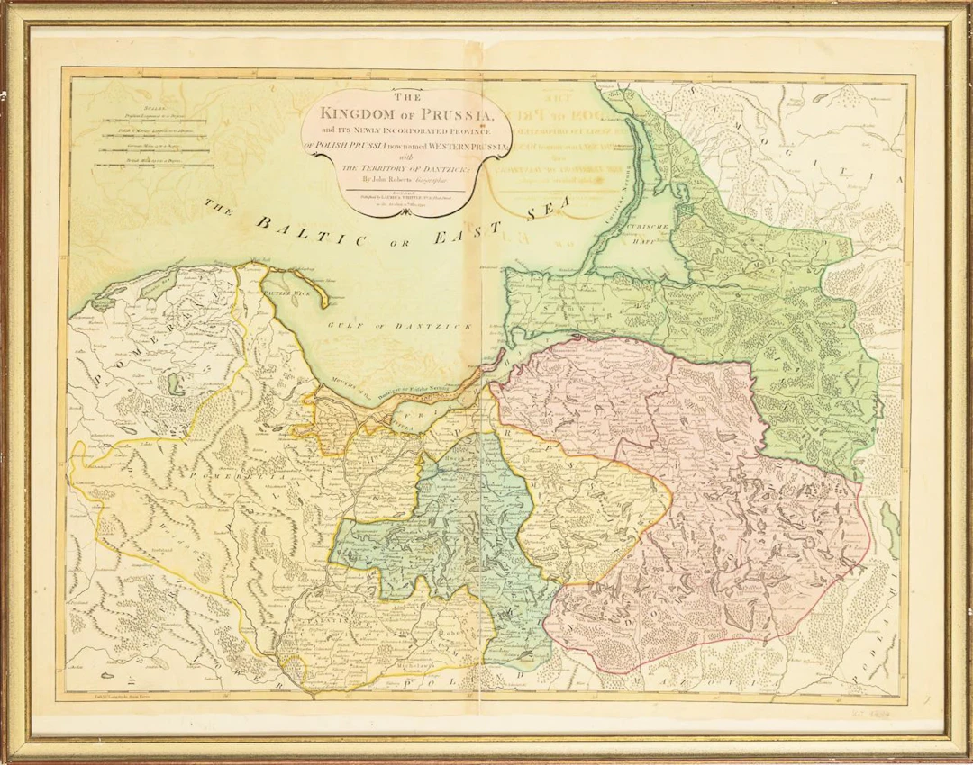
Map of Prussia and the Baltic SeaArea-colored copperplate engraving.46 x 62 cm. Framed & under glass : 56 x 71 cm."The Kingdom of Prussia and its newly Incorporated province of Polish Prussia now named Western Prussia with the territory of Dantzick," by John Roberts, London 1794. Middle-crease ripped. Visible imprints from the reverse side, from previous folding of the sheet.*This is an automatically generated translation from German by deepl.com and only to be seen as an aid - not a legally binding declaration of lot properties. Please note that we can only guarantee for the correctness of description and condition as provided by the German description.
Utropspris:SEK 677.91
Till auktionenVisa alla föremål frånWendl AuktionshausellerBöcker, Kartor och Texter
Utropspris:
SEK 677.91
Liknande föremål



Slutpriser för liknande föremål


Nå samlare över hela världen med din auktion!
Lista er auktion